Recreation
Running Routes in Kelowna
Kelowna Team
Facts checked · How we check facts
Summary
The best places to run in Kelowna: flat paths, steep trails, and how to avoid the summer crowds and the goose poop.
In this article:
The best running routes in Kelowna are the Mission Creek Greenway for long flat miles, the Waterfront Boardwalk downtown and the Knox Mountain Apex Trail for hill work. This guide covers ten routes, from paved lakeside paths to singletrack in Myra-Bellevue, with the start point, surface and main drawback of each. The practical challenges are summer crowds, geese and midday heat, and each entry notes how to avoid them.
| Route | Surface | Best for |
|---|---|---|
| Mission Creek Greenway | Crushed gravel | Long, easy distance |
| Waterfront Boardwalk | Paved | Short out-and-back downtown |
| Knox Mountain | Paved road, or dirt and stairs | Hill training |
| Okanagan Rail Trail | Paved, then hard-packed gravel | Half-marathon and marathon training |
| Abbott Street Corridor | Paved | Easy shakeout runs |
| Crawford Trails (Myra-Bellevue) | Singletrack dirt | Trail running |
| Brandt's Creek Linear Park | Pavement and gravel | Everyday runs in Glenmore |
| Kalamoir Regional Park | Dirt | Rolling lakeside trail |
| Rose Valley Regional Park | Technical trail | Elevation and ultra training |
| Myra Canyon trestles | Old railway bed | Flat running at elevation |
Mission Creek
Mission Creek Greenway
Starts at Lakeshore Road, or park at the EECO Centre at 2363 Springfield Rd. Free. Open dawn to dusk.
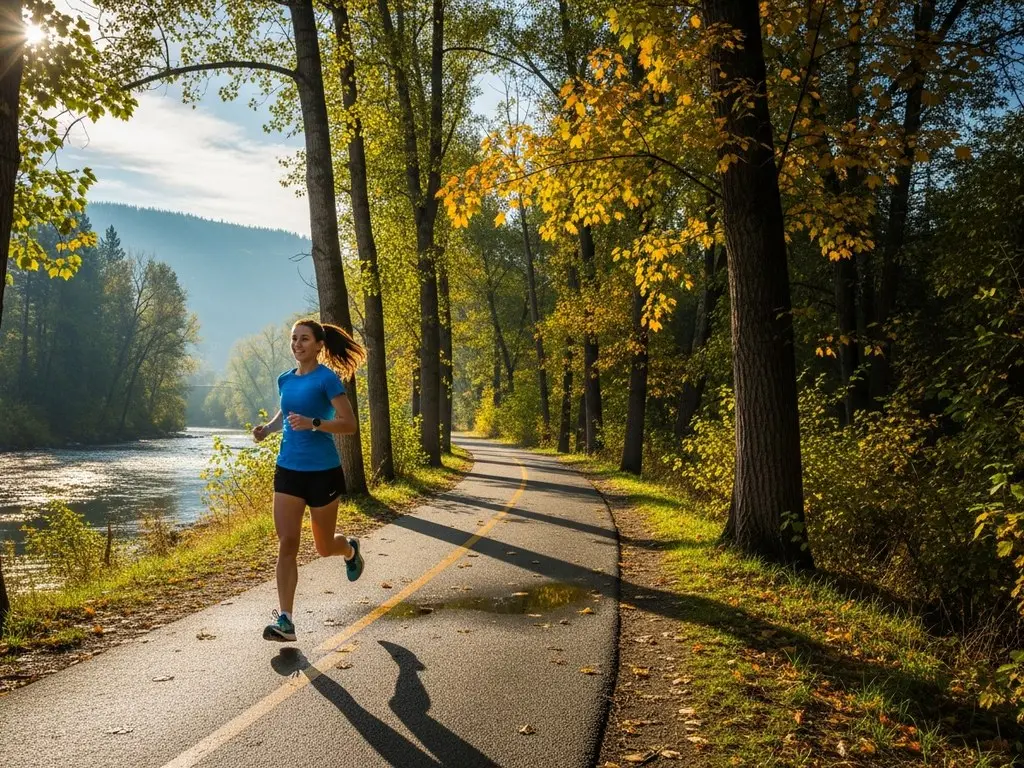
The Mission Creek Greenway is Kelowna's standard long run: a wide, flat, crushed gravel path that follows the creek for roughly 16 kilometres, away from traffic. Cottonwoods shade the lower half near the lake; the upper half toward Rutland is more rugged and exposed. Kilometre markers painted on the rocks help with pacing, and in September the kokanee spawning is noticeable along the creek.
The downside: in spring the creek floods and washes out the underpasses beneath the road bridges, so expect wet feet. Bears feed on berries past East Kelowna Road. Stay alert on that section.
Downtown Boardwalk
Waterfront Boardwalk
Starts at City Park (1600 Abbott St) and runs north to Knox Mountain. Free. Paid street parking nearby; check the City of Kelowna for current rates.
The boardwalk is a paved, flat path along the lake from City Park to Knox Mountain, passing the big white sails, the downtown marina and Waterfront Park. At roughly 3 kilometres one way, it works as a short out-and-back for anyone who lives or works downtown. The lake breeze helps on hot July mornings.
The downside: in July and August, run before 7 AM. By 9 AM the path is crowded with tourists, off-leash dogs and children on scooters, and holding a steady pace isn't realistic.
Knox Mountain
Knox Mountain Apex Trail
450 Knox Mountain Drive. Free. Check the City of Kelowna for current seasonal gate hours on the summit road.
Knox Mountain is the main hill-training option close to downtown. There are two ways up: the paved road, a steady climb of constant switchbacks, or the Knox Mountain Apex Trail, a steep climb of dirt and wooden stairs. The summit looks south over the bridge. For a flatter run, Paul's Tomb trail is a dirt track along the side of the mountain above the water.
The downside: the front face has no shade, and the rocks reflect heat. Avoid it at 2 PM in summer. After a dry month, the trails are very dusty.
Rail Trail
Okanagan Rail Trail
Starts at Clement Ave and Gordon Drive. Free. Open 24/7.
The Okanagan Rail Trail runs all the way to Vernon, and the flat Kelowna section suits half-marathon and marathon training blocks. It's paved for the first long stretch, then hard-packed gravel further out, and it passes through Glenmore, the industrial zone and out by the airport. Steady pacing is easy here.
The downside: the stretch from downtown to Dilworth Road runs behind warehouses, chain-link fences and car dealerships. Expect e-bikes travelling at around 30 km/h, often without ringing a bell, and strong headwinds from the north in the late afternoon.
Abbott Street
Abbott Street Corridor
Starts at City Park and goes south into the Mission. Free. Open 24/7.
The Abbott Street Corridor is a two-way path built for bikes and pedestrians, running through the heritage neighbourhood and into the Mission. It's flat, paved and shaded by mature trees. It suits an easy Sunday shakeout run, with cafes and bakeries nearby.
The downside: every cross street has a stop sign. Drivers waiting to pull onto Abbott Street often stop across the path, so watch each intersection.
Crawford Trails
Myra-Bellevue Provincial Park
Stewart Road East parking lot. Free. Dawn to dusk.
The Crawford Trails in Myra-Bellevue Provincial Park are dozens of kilometres of singletrack in East Kelowna and the main option for true trail running. Expect roots, rocks, pine needles and some steep climbs. The forest is quiet and noticeably cooler than the valley floor when it reaches 35 degrees.
The downside: this is also the main local mountain biking area, and on Saturday mornings runners regularly step aside for downhill riders. Keep one earbud out. Cell service is unreliable and the trail network is complex, so carry an offline map.
Brandt's Creek
Brandt's Creek Linear Park
Starts near Cross Road and Glenmore Road. Free. Open 24/7.
Brandt's Creek Linear Park is the everyday route for Glenmore residents. The pavement-and-gravel path winds behind subdivisions and through small neighbourhood parks, separated from the main roads despite its central location. It's fairly flat, well maintained and passes a few coffee spots.
The downside: ducks and geese use the path heavily, become territorial in spring and leave droppings throughout. The route also crosses several busy Glenmore roads with slow pedestrian signals.
Kalamoir
Kalamoir Regional Park
Collens Hill Road, West Kelowna. Free. Open dawn to dusk.
Kalamoir Regional Park, across the bridge in West Kelowna, has a main trail that follows the edge of the lake. The terrain rolls gently, the dirt is soft and the tree cover blocks most highway noise. Run out to the point and loop back. A June 16, 2026 wildfire closed Kalamoir; the RDCO reopened the southern portion from the Collens Hill Road entrance on July 3, 2026, while the northern section toward Casa Loma stayed closed for hazard work. Check RDCO's regional parks news for current access before you go.
The downside: bridge traffic. Avoid driving over between 3 PM and 6 PM on weekdays, when the crossing can take an hour. Early weekend mornings work best.
Rose Valley
Rose Valley Regional Park
Westlake Road, West Kelowna. Free. Open dawn to dusk.
Rose Valley Regional Park is a West Kelowna trail network that loops around the reservoir, suited to runs with serious elevation and technical footing. It's heavily wooded and quiet. Runners training for an ultra can link together long, demanding routes.
The downside: signage is poor, and unofficial side trails can dead-end at a steep ravine. Carry a fully charged phone. The trails get icy in winter; microspikes are needed from December through February.
Myra Canyon
Kettle Valley Railway Trestles
Myra Forest Service Road. Free to access. Open 24/7.
The Kettle Valley Railway Trestles in Myra Canyon follow an old railway bed above East Kelowna, with a maximum grade of two percent. The route is flat but sits at about 1,200 metres, crossing wooden trestle bridges and passing through rock tunnels. Temperatures are noticeably cooler than in town.
The downside: the drive takes about 40 minutes from downtown, ending with roughly 8 km of rutted, washboard forest service road. In peak summer the trail is busy with families on rented bikes. October is quieter and cooler.
Frequently Asked Questions
Where is the best place for a flat, long run in Kelowna?
The Mission Creek Greenway and the Okanagan Rail Trail. The Greenway is crushed gravel and the Kelowna section of the Rail Trail is paved. Either one allows 15 to 20 kilometres without a steep hill.
Are there water fountains on the running routes?
Only on the downtown boardwalk and at City Park. Carry water everywhere else, especially on Knox Mountain or the Crawford trails, where the heat is intense.
Do I need trail running shoes for Knox Mountain?
Only for the steep dirt Apex trail. The paved road and the flatter Paul's Tomb trail are fine in regular road shoes.
Is it safe to run at night in Kelowna?
The Abbott Street corridor and downtown are the safest options after dark. The greenways and rail trails have no street lighting, and coyotes and deer are active at night.
When does the snow clear off the trails in Kelowna?
Valley-bottom routes like the downtown boardwalk and Abbott Street are usually clear by early March. High-elevation trails like Myra Canyon hold snow and ice until May.